Property Record
1846 Route 1, North Brunswick, NJ 08902

NEARBY LISTINGS FOR SALE OR LEASE
Property Detail
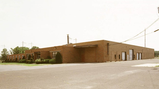
1846 Route 1
14-00143-0000-00013-01
3.99 AC
Gymhealthspa
Middlesex
X
New Jersey
34023C0128F
13.1
2024
3.99 AC
2025
Brunswick/Exit 9
006207
Northern New Jersey
29,164 SF
New York-Jersey City-White Plains, NY-NJ
DEMOGRAPHICS near 1846 Route 1
1 Mile
3 Mile
5 Mile
2024 Total Population
14,072
84,224
224,185
2029 Population
13,971
83,587
223,084
Pop Growth 2024-2029
(0.72%)
(0.76%)
(0.49%)
Average Age
39
38
38
2024 Total Households
4,920
28,314
76,608
HH Growth 2024-2029
(0.79%)
(0.75%)
(0.36%)
Median Household Inc
$103,527
$97,867
$97,044
Avg Household Size
2.80
2.80
2.70
2024 Avg HH Vehicles
2.00
2.00
2.00
Median Home Value
$388,614
$386,607
$403,392
Median Year Built
1982
1979
1978
Nearby Places
Map Layers
Map Styles
 Street
 Aerial
- Restaurants
- Banks
- Shops
- Fitness
- Groceries
PUBLIC TRANSPORTATION
COMMUTER RAIL
Jersey Avenue (Northeast Corridor Line - NJ Transit Commuter Rail (NJ Transit))
DRIVE
WALK
Distance
Jersey Avenue (Northeast Corridor Line - NJ Transit Commuter Rail (NJ Transit))
9 min
2.4 mi
New Brunswick (Northeast Corridor Line - NJ Transit Commuter Rail (NJ Transit))
DRIVE
WALK
Distance
New Brunswick (Northeast Corridor Line - NJ Transit Commuter Rail (NJ Transit))
10 min
4.2 mi
AIRPORT
Trenton Mercer
DRIVE
WALK
Distance
Trenton Mercer
39 min
24.8 mi
Newark Liberty International
DRIVE
WALK
Distance
Newark Liberty International
43 min
30.4 mi
LaGuardia
DRIVE
WALK
Distance
LaGuardia
74 min
47.8 mi
Freight Ports
New York Container Terminal
DRIVE
WALK
Distance
New York Container Terminal
37 min
25.5 mi
Nearby Properties
Address
Land Use
TOTAL SIZE
Lot Size
Zoning
Address
Land Use
TOTAL SIZE
Lot Size
Zoning
25.77 AC
C-6
Address
Land Use
TOTAL SIZE
Lot Size
Zoning
99.79 AC
B-I
Address
Land Use
TOTAL SIZE
Lot Size
Zoning
77.04 AC
I2
Address
Land Use
TOTAL SIZE
Lot Size
Zoning
31.07 AC
ERR
Address
Land Use
TOTAL SIZE
Lot Size
Zoning
543,945 SF
48.46 AC
B-I
Address
Land Use
TOTAL SIZE
Lot Size
Zoning
34.75 AC
CR
Address
Land Use
TOTAL SIZE
Lot Size
Zoning
27.23 AC
CR
Address
Land Use
TOTAL SIZE
Lot Size
Zoning
103.93 AC
ERR
Address
Land Use
TOTAL SIZE
Lot Size
Zoning
8,430 SF
10.51 AC
I-2
Address
Land Use
TOTAL SIZE
Lot Size
Zoning
46.85 AC
ERR
Address
Land Use
TOTAL SIZE
Lot Size
Zoning
283,080 SF
34.62 AC
CR
Address
Land Use
TOTAL SIZE
Lot Size
Zoning
419,094 SF
49.17 AC
CR
Address
Land Use
TOTAL SIZE
Lot Size
Zoning
18.50 AC
I-2
Address
Land Use
TOTAL SIZE
Lot Size
Zoning
27.88 AC
C2
Address
Land Use
TOTAL SIZE
Lot Size
Zoning
46.33 AC
I2
Address
Land Use
TOTAL SIZE
Lot Size
Zoning
2.65 AC
R-6
Address
Land Use
TOTAL SIZE
Lot Size
Zoning
5.19 AC
I-2
Address
Land Use
TOTAL SIZE
Lot Size
Zoning
6.80 AC
R-6
Address
Land Use
TOTAL SIZE
Lot Size
Zoning
95,064 SF
14.41 AC
CR
Address
Land Use
TOTAL SIZE
Lot Size
Zoning
42.66 AC
PUD2
Address
Land Use
TOTAL SIZE
Lot Size
Zoning
1,071 SF
5.17 AC
CI
Address
Land Use
TOTAL SIZE
Lot Size
Zoning
192,072 SF
19.83 AC
CR
Address
Land Use
TOTAL SIZE
Lot Size
Zoning
29,992 SF
2 AC
RC
Address
Land Use
TOTAL SIZE
Lot Size
Zoning
30,000 SF
74.57 AC
R15
Address
Land Use
TOTAL SIZE
Lot Size
Zoning
1,944 SF
2.01 AC
HBD
Address
Land Use
TOTAL SIZE
Lot Size
Zoning
23.39 AC
PUD2
Address
Land Use
TOTAL SIZE
Lot Size
Zoning
54,886 SF
5.21 AC
C-6
Address
Land Use
TOTAL SIZE
Lot Size
Zoning
800 SF
9.14 AC
B-I
Address
Land Use
TOTAL SIZE
Lot Size
Zoning
5,376 SF
5.60 AC
R7
Address
Land Use
TOTAL SIZE
Lot Size
Zoning
4,066 SF
30.42 AC
CR
The World's #1 Commercial Real Estate Marketplace
Connect with us
© 2025 CoStar Group
The information above has been obtained from sources believed reliable. While we do not doubt its accuracy we have not verified it and make no guarantee, warranty or representation about it. It is your responsibility to independently confirm its accuracy and completeness. Any projections, opinions, assumptions, or estimates used are for example only and do not represent the current or future performance of the property. The value of this transaction to you depends on tax and other factors which should be evaluated by your tax, financial, and legal advisors. You and your advisors should conduct a careful, independent investigation of the property to determine to your satisfaction the suitability of the property for your needs.